Join the Global Flood Partnership Fall Webinar Series! This event will feature three exciting presentations from distinguished experts in the field, focusing on Earth Observation data.
- When: November 19th, 2025, 4:00–5:30 p.m. CET
- Recordings are available below each speaker introduction!
This season’s series of the Global Flood Partnership (GFP) focuses on the use of Earth Observation data to strengthen adaptation, mitigation, and resilience strategies for flood disasters. The webinar will feature three distinguished speakers:
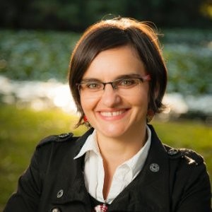
Professor Mirela Tulbure (North Carolina State University)

Title: Next-Generation Flood Mapping: Scaling Global Flood Monitoring with Multi-Sensor Fusion and Foundation Models
Abstract: Floods are among the most devastating weather-related hazards, affecting millions and causing billions in damage each year. As climate change amplifies the frequency and severity of extreme events, new tools are needed to translate the growing wealth of Earth observation (EO) data into actionable intelligence for disaster resilience.
In this talk, I will present recent advances from our Geospatial Analysis for Environmental Change Lab on large-scale flood mapping using multi-sensor fusion and Geospatial Foundation Models. Our work integrates over 85 global flood events into a harmonized training dataset, enabling the fine-tuning of foundation models such as ESA-IBM’s TerraMind for rapid flood detection and impact assessment.
We demonstrate that combining complementary data streams — optical, radar, and topography — yields near-real-time maps with high accuracy. I will discuss how these approaches can bridge the gap between science and applications, supporting humanitarian operations, climate adaptation, and flood risk management at scale.
By advancing AI-driven flood analytics from research to operations, this work lays the foundation for global resilience — enabling governments, insurers, and relief organizations to act faster and with greater confidence.
Bio: Mirela G. Tulbure is the Chancellor’s Faculty Excellence Program Professor in Geospatial Analytics at North Carolina State University, where she leads the Geospatial Analysis for Environmental Change Lab. Her research integrates satellite time series, machine learning, and deep learning to map surface water and flood dynamics globally. She currently leads NASA-funded projects that quantify the impacts of floods on people and infrastructure, supporting disaster preparedness and climate adaptation worldwide. Learn more about her work at her lab website and connect with her on LinkedIn.
The recordings of this presentation can be viewed at: https://youtu.be/DlEJDc-PefM
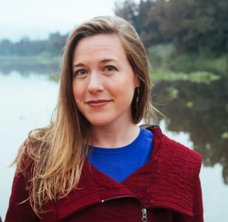
Assistant Professor Beth Tellman (University of Wisconsin–Madison)

Title: Which AI methods make better flood maps with satellite images? Results from human-in-the-loop approaches, geofoundational models, and commercial sensor fusion.
Abstract: As AI advances remote sensing in general and flood mapping in particular, which new methods and models actually make a meaningful difference in accuracy across sensors and enable new insights for better flood adaptation and response? To answer this question, this talk will show the latest experiments from the Social Pixel lab in three AI domains 1) Geo-foundational Models (Privthi, Clay, and DOFA) 2) Human-in-the-Loop (using resident flood experiences to fine-tune a CNN) 3) Sensor fusion to deploy new algorithms with higher accuracy on VIIRS and MODIS (Giezendanner et al 2023), and the role of commercial imagery to enable accuracy advances on public sensors (Zhang et al 2025).
Website: https://beth-tellman.github.io/Bio: Beth is an Assistant Professor at the University of Wisconsin-Madison, in the Nelson School of Environmental Studies whose research addresses the causes and consequences of global environmental change on people, with a focus on flood risk and land use change. She engages in multiple disciplines and methods to “socialize the pixel” or understand the social processes behind environmental change captured in satellite image pixels and leverage satellite data to improve human well-being. She is a co-founder and Chief Science Officer of Floodbase, a public benefit corporation that leverages remote sensing to build flood parametric insurance products.
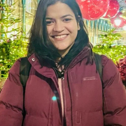
The recordings of this presentation can be viewed at: https://youtu.be/V8AyaPk3K44Dr. Ekta Aggarwal (University of Southampton, UK)

Title: Understanding Flood-Induced Human Mobility Using Facebook Data: A Case Study of the 2024 Bihar Floods, India
Abstract: Flooding remains the most significant and widespread natural hazard globally, and its frequency and intensity are projected to increase because of ongoing social and environmental change. Beyond the immediate destruction of infrastructure and livelihoods, flood events can also trigger population movements—both temporary relocations and permanent migrations away from high-risk areas. Understanding these mobility patterns is critical for designing effective disaster response, recovery, and long-term resilience strategies. This study adopts an innovative data-driven approach to investigate human mobility during extreme weather events, focusing specifically on floods in socio-economically vulnerable regions. Instead of relying on conventional data sources such as census records, household surveys, and travel diaries, we utilise the Data for Good programme at Meta. This dataset leverages anonymised mobile phone and internet location history to capture real-time, large-scale human mobility patterns with a higher degree of spatial and temporal resolution. Thus, the study aims to understand how socio-economic and demographic factors influence population mobility during flood events. Secondly, to assess whether mobility and geospatial data can support the identification of evacuation hotspots and enhance flood risk prediction and recovery planning. Lastly, the study aims to identify the spatio-temporal patterns of flood-induced mobility across countries of varying income levels.
Bio: Ekta is a research fellow working at the School of Geography and Environmental Science, University of Southampton, UK, in the UKRI-funded Evoflood Project with WorldPop. Her research focuses on using geospatial datasets to understand how natural hazards impact communities around the world. Currently, she is investigating population mobility and vulnerability to global flooding, essentially tracking how people respond to disasters. Before this, she pursued her PhD as a Marie Curie Early-Stage Researcher at Imperial College London, UK, where she analysed the impact of flooding and flood risk assessment in the Indus-Ganga Basin, using the night-time lights. More about her can be found on her LinkedIn (https://www.linkedin.com/in/dr-ekta-aggarwal-a82588121).
The recordings of this presentation can be viewed at: https://youtu.be/jxFCi3butbU
- Log in to post comments